Planning project · Planning application
Lot line adjustment sought for 0.49-acre residential property with manufactured home
The application would shift a property line between residential parcels through a recorded survey. City staff will review it administratively, with no public hearing listed. It was filed May 20.
About this application
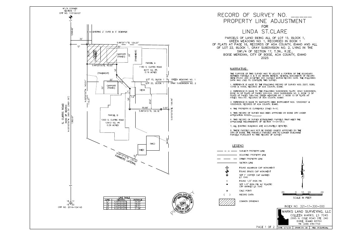
Residential Parcel Line Adjustment via a Record of Survey
Project name on file: 1180 S CURTIS RD
Timeline
Two days ago
5 documents added
Aug. 21, 2026
Planning Applications: Notes
Reopened per Mel Trout
Aug. 21, 2026
Planning Applications: Generate Additional Application
July 10, 2026
Project Cancellation: Expired
PLN expired, applicant did not respond to email after 6 months of inactivity.
June 13, 2025
Concept Review Complete: CR Complete - Type 2
May 20, 2025
Application Submittal: Online
May 20, 2025
Application filed
Documents
Site plans
- Download PDS-Other Small Docs - SITE PLAN SHOWING ADJUSTED PROPERTY LINE BETWEEN PARCELS A & B
May 20, 2025 · 1 page · 108 KB · PDS-Other Small Docs
Other documents
- PDS-Concept Review Summary Report -
June 13, 2025 · 447 KB · PDS-Concept Review Summary Report
- PDS-Application
May 20, 2025 · 154 KB · PDS-Application
- PDS-Maps and Drawings - RECORD OF SURVEY 5.20.2025
May 20, 2025 · 137 KB · PDS-Maps and Drawings
- PDS-Other Small Docs - LETTER OF INTENT
May 20, 2025 · 238 KB · PDS-Other Small Docs