Planning project · Planning application
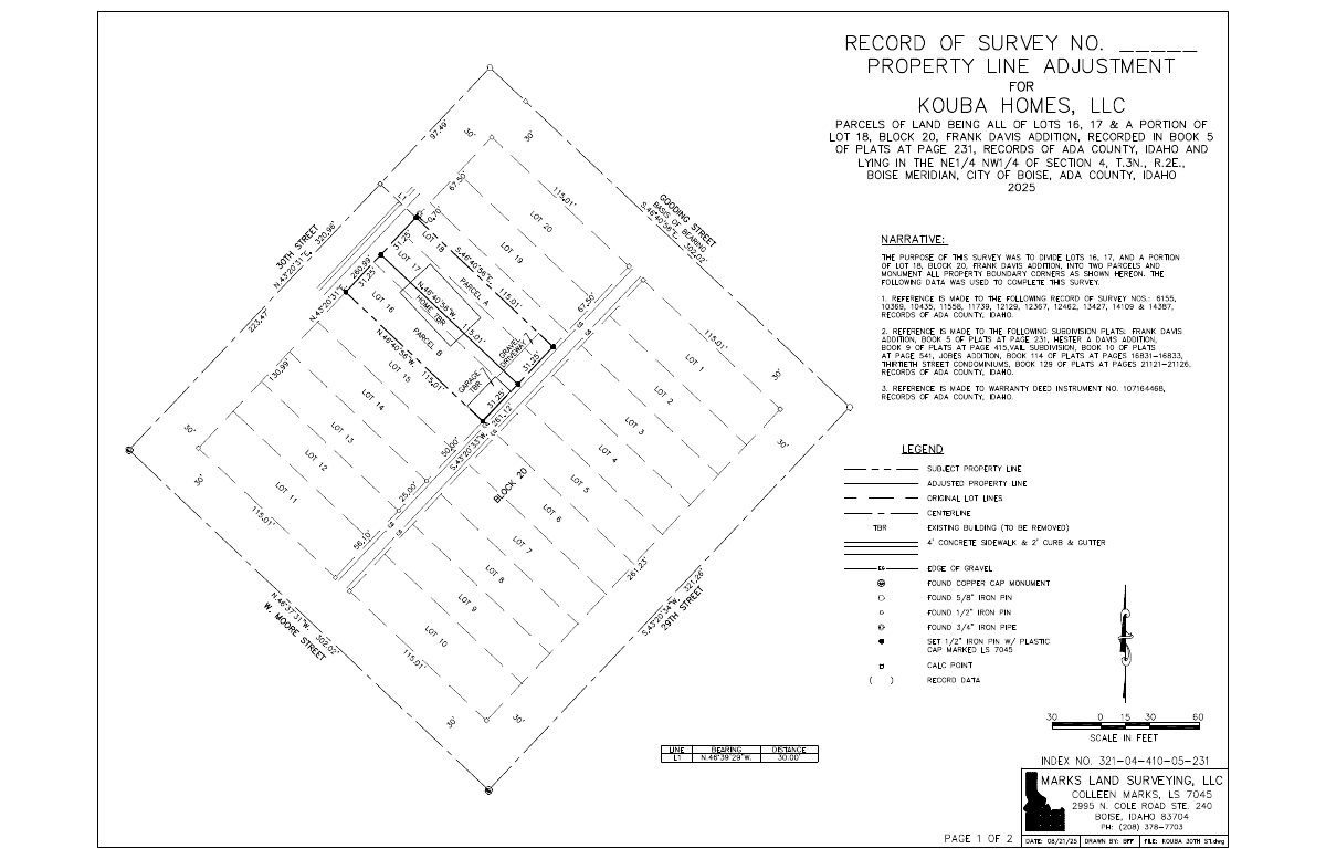
Parcel line adjustment and demolition of existing structures sought on 0.16-acre lot
The application asked to adjust a parcel line and remove existing structures on a residential lot of about 0.16 acres. It was filed Aug. 21, 2025, and its status is now listed as expired.
About this application
Record of Survey - Parcel Line Adjustment, Demolition
Project name on file: 886 N 30TH ST
Timeline
July 10, 2026
Project Cancellation: Expired
PLN expired, applicant did not respond to email after 6 months of inactivity.
Sept. 11, 2025
Pending Application Submittal: Planning Applications in Review
Sept. 11, 2025
Concept Review Complete: CR Complete - Type 2
Sept. 5, 2025
Concept Review Complete: Notes
emailed to set up CR 9.5.2025
Aug. 21, 2025
Application Submittal: Online
Aug. 21, 2025
Application filed
Documents
Site plans
- Download Record of survey for property line adjustment
Survey by Marks Land Surveying dividing lots 16, 17 and part of lot 18 into two parcels, noting the existing building to be removed and boundary monuments set.
Aug. 21, 2025 · 1 page · 96 KB · PDS-Other Small Docs
Project narrative
- Download Letter of intent regarding a planning application
Aug. 21, 2025 · 26 KB · PDS-Other Small Docs
Other documents
- PDS-Concept Review Summary Report -
Sept. 11, 2025 · 446 KB · PDS-Concept Review Summary Report
- PDS-Application
Aug. 21, 2025 · 154 KB · PDS-Application