Record of survey · Planning application
Property line adjustment between two homes returned to applicant
The request would shift the shared boundary between two residential lots to match existing fencing and improvements. No new lots would be created. The city returned the application to the applicant, and it is on hold.
From the filing
The application's description as it appears in City of Boise's record. See the official record
Property Line Adjustment
Project name on file: 1105 N HOUSTON RD
Timeline
Dec. 11, 2025
Review Complete: Corrections Required
Dec. 11, 2025
Current Planning: Corrections Required
Nov. 24, 2025
Current Planning: In Review
Nov. 24, 2025
Assign Reviewers: Completed
Nov. 12, 2025
Fee Payment: Payment Received
Nov. 12, 2025
Prescreen Review: Passed
Nov. 11, 2025
Prescreen Review: In Progress
Nov. 10, 2025
Prescreen Review: Corrections Required
Nov. 7, 2025
Prescreen Review: In Progress
Nov. 4, 2025
Application Submittal: ePlanReview
Nov. 4, 2025
Application filed
Documents
Plans
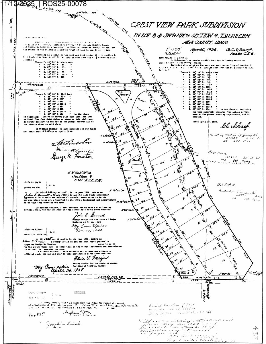
- Download Crest View Park subdivision record of survey plat, 1938
Scanned 1938 plat of the Crest View Park subdivision, with surveyor's certificate, owners' dedication of streets to the public, and notary acknowledgments; the text is largely illegible OCR.
Nov. 25, 2025 · 1 page · 197 KB · PDS-Maps and Drawings
Project narrative
- Download Letter of intent for property line adjustment
Cover letter from KM Engineering submitting a record of survey property line adjustment to align a common lot boundary with existing fencing and improvements, with no new parcels created.
Nov. 25, 2025 · 1 page · 161 KB · PDS-Letter of Intent
Application
- Download Record of survey application for property line adjustment
Application for a property line adjustment on a 0.18-acre residential lot in an R-1C zone, keeping two lots with existing sewer and water connections.
Nov. 25, 2025 · 2 pages · 206 KB · PDS-Application
- Download Record of survey application for property line adjustment
Application form for a property line adjustment record of survey on a residential R-1C parcel, keeping two lots, with applicant, owner and project details.
Nov. 4, 2025 · 2 pages · 204 KB · PDS-Application
Photos
- Download Site photographs
Two photos of the site, including a Google map view and a coordinate and elevation overlay, with a date stamp of 3/16/2021.
Nov. 25, 2025 · 2 pages · 5.6 MB · PDS-Photos
Other documents
- Transmittal sheet to agencies
Nov. 28, 2025 · 100 KB · PDS-Transmittal Agencies
- Deed No. 2
Nov. 25, 2025 · 145 KB · PDS-Other Small Docs
- Parcel A legal description
Nov. 25, 2025 · 500 KB · PDS-Other Small Docs
- Parcel B legal description
Nov. 25, 2025 · 513 KB · PDS-Other Small Docs
- Statement of legal interest
Nov. 25, 2025 · 1.3 MB · PDS-Statement of Legal Interest
- Submittal checklist
Nov. 25, 2025 · 898 KB · PDS-Submittal Checklist
- Payment receipt
Nov. 12, 2025 · 134 KB · PDS-Receipts
