Comprehensive plan amendment · Planning application
Kuna council approves shrinking city's area of impact by 5,531 acres
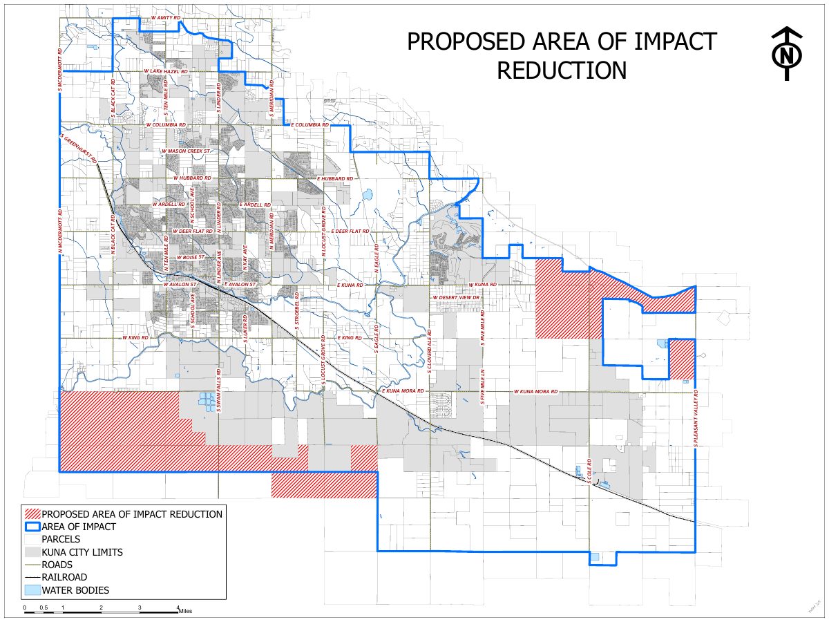
The Kuna City Council approved removing about 5,531 acres, mostly state and federal land, from the city's area of impact boundary on Feb. 3. The city says two parcels totaling 940 acres were split by the boundary in conflict with state code.
From the filing
The application's description as it appears in City of Kuna's record. See the official record
Comprehensive Plan Amendment application to remove approximately 5,531 acres from the City of Kuna Area of Impact boundary.
Project name on file: Area of Impact Boundary Reduction
Timeline
Feb. 17, 2026
Kuna City Council adopted its decision
Its decision and reasoned statement, on its consent agenda.
Feb. 3, 2026
Approved
Kuna City Council: Approved.
Feb. 3, 2026
Public hearing: Kuna City Council
Jan. 27, 2026
Kuna Planning and Zoning Commission adopted its recommendation to the City Council
Its recommendation and reasoned statement, on its consent agenda.
Dec. 9, 2025
Public hearing: Kuna Planning and Zoning Commission
Documents
Site plans
- Download Proposed area of impact reduction map
Map showing the proposed reduction of the city's area of impact, with parcels, city limits, roads, railroad and water bodies.
Feb. 18, 2026 · 1 page · 1.4 MB
Project narrative
- Download Cover narrative for area of impact reduction
Staff cover letter submitting the application to reduce the Kuna area of impact, mostly state and federal land totaling about 5,531 acres.
Feb. 18, 2026 · 1 page · 106 KB