Property boundary adjustment · Planning application
Plan would reshape two parcels totaling about 77 acres into five lots
A lot split request would divide two parcels of irrigated pasture, about 76.6 acres combined, into five for future development. It is a condition of an earlier annexation approval and is under city review.
From the filing
The application's description as it appears in City of Nampa's record. See the official record
Lot spilt from (2) lots to (5) lots
Project name on file: Lot Split for Murphy Development project
Timeline
Sept. 21, 2026
Assess Fees (Home)
Sept. 18, 2026
Completeness Check
Sept. 15, 2026
8 documents added
Sept. 15, 2026
Application filed
Documents
Site plans
- Download Existing record of survey for the property
Record of survey showing boundary monuments, lot lines, acreage and easements for the parcel in the property boundary adjustment application.
Sept. 15, 2026 · 2 pages · 1.4 MB · Other/Misc.
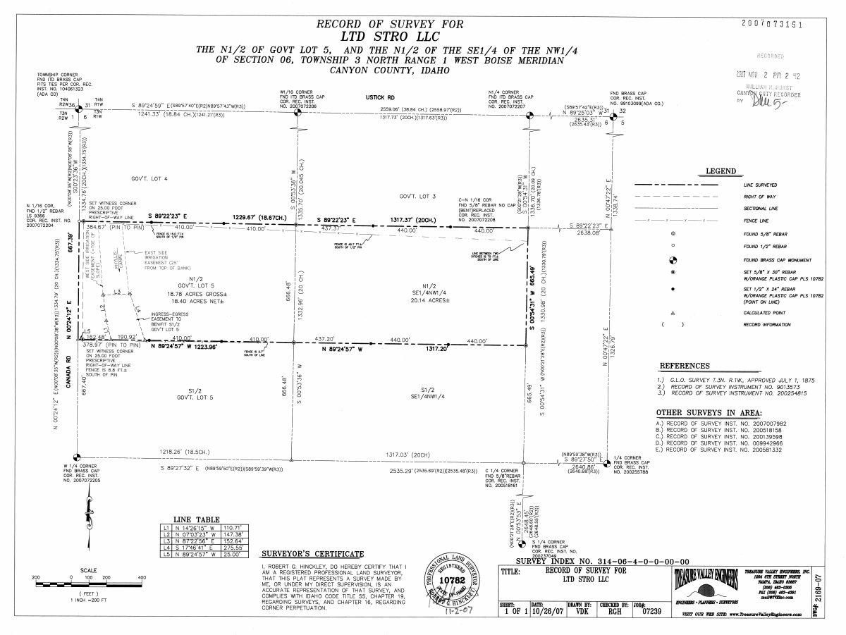
- Download Record of survey for lot split
Survey map showing boundary lines, parcel acreages, easements and surveyor's certificate for the property boundary adjustment, with a recorder's certificate block.
Sept. 15, 2026 · 1 page · 561 KB · Record of Survey
Project narrative
- Download Cover letter for lot split application
Cover letter from The Land Group, Inc. submitting a lot split that divides two existing parcels into five, as conditioned by a prior annexation approval.
Sept. 15, 2026 · 2 pages · 354 KB · Narrative
Other documents
- Affidavit of legal interest
Sept. 15, 2026 · Affidavit of Legal Interest
- Master application form
The master application form for a property boundary adjustment, filed with the planning application.
Sept. 15, 2026 · Checklist & Master Application
- Download Special warranty deed for Nampa Point Associates property
Recorded special warranty deed conveying Canyon County property from Scripps Ranch Technology Park, LLC to Nampa Point Associates, LLC, offered as proof of ownership interest.
Sept. 15, 2026 · 6 pages · 267 KB · Proof of Proprietary Interest
- Property boundary lot split checklist
Sept. 15, 2026 · Checklist & Master Application
- Vicinity map
Sept. 15, 2026 · Vicinity Map