Property boundary adjustment · Planning application
Lot line adjustment approved to combine three lots for assisted living site
Nampa approved a boundary adjustment on Sept. 15 for the Streamside Assisted Living property, which has a commercial building. Pre-application notes describe combining lots into one and connecting two structures.
From the filing
The application's description as it appears in City of Nampa's record. See the official record
Streamside Assisted Living Lot Line Adjustment.
Project name on file: Streamside Assisted Living Lot Line Adjustment.
Timeline
Sept. 15, 2026
Issue Property Boundary Adjustment Document
Sept. 15, 2026
Decision: Approved
Sept. 14, 2026
Planning PBA Application Review
Sept. 11, 2026
Assess Fees (Home)
Sept. 10, 2026
Completeness Check
Sept. 10, 2026
9 documents added
Sept. 10, 2026
Application filed
Documents
Site plans
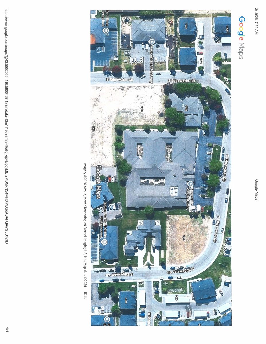
- Download Google Maps aerial site view
A one-page aerial imagery printout from Google Maps, captured March 19, 2026, labeled as a site plan for this boundary adjustment application.
Sept. 10, 2026 · 1 page · 634 KB · Site Plan
Project narrative
- Download Project narrative for lot consolidation and parking
Streamside Assisted Living proposes combining four lots into one, building a parking lot on one lot, and connecting two structures with a breezeway.
Sept. 10, 2026 · 1 page · 167 KB · Narrative
- Download Pre-application notes from planning staff
Planning and Zoning property inquiry notes covering a proposed lot combination and connecting two structures, with zoning references and next application steps.
Sept. 10, 2026 · 1 page · 298 KB · Pre App Notes
Application
- Download Master application for property boundary adjustment
City of Nampa master application form for a property boundary adjustment, listing applicant, owner, contractor and subject property information.
Sept. 10, 2026 · 2 pages · 658 KB · Application
Other documents
- Affidavit for Streamside Assisted Living
Sept. 10, 2026 · Affidavit
- Application checklist
Sept. 10, 2026 · Checklist
- Download Record of survey for property boundary adjustment
Recorded survey plat showing the legal description from the title commitment, curve table, reference documents, and surveyor's notes for the adjusted parcels.
Sept. 10, 2026 · 3 pages · 558 KB · Old Plat
- Download Record of survey and lot consolidation
Boundary re-tracement survey of Lots 4 through 7, Block 2 of Hines Professional Park, prepared by Sawtooth Land Surveying for the property owner, with notes on discrepancies between monuments and recorded plat data.
Sept. 10, 2026 · 1 page · 2.9 MB · ROS
- Warranty deed
Sept. 10, 2026 · Warranty Deed


