Planning project · Planning application
Property line adjustment sought to fix setback and driveway problems between two homes
The request would move the shared boundary between two residential lots on about 0.16 acres to resolve setback and driveway issues. City staff are reviewing it administratively, and no new homes are planned.
From the filing
The application's description as it appears in City of Boise's record. See the official record
Property line adjustment
Project name on file: 111 N BACON DR
Timeline
Oct. 13, 2026
14 documents added
April 10, 2026
Pending Application Submittal: Planning Applications in Review
July 17, 2025
Concept Review Complete: CR Complete - Type 2
July 11, 2025
Concept Review Complete: Corrections Required
Please upload a site plan that shows the configuration of the lot lines as they are and the new lot line as proposed. Please also show the distance from all structures to the new, proposed property line. We cannot approve a lot line adjustment that creates a non-conformity (structures that don't meet setbacks). If structures are to be removed, please include that on the site plan as well.
July 3, 2025
Application Submittal: Online
July 3, 2025
Application filed
Documents
Site plans
- Download Record of survey for lot line adjustment
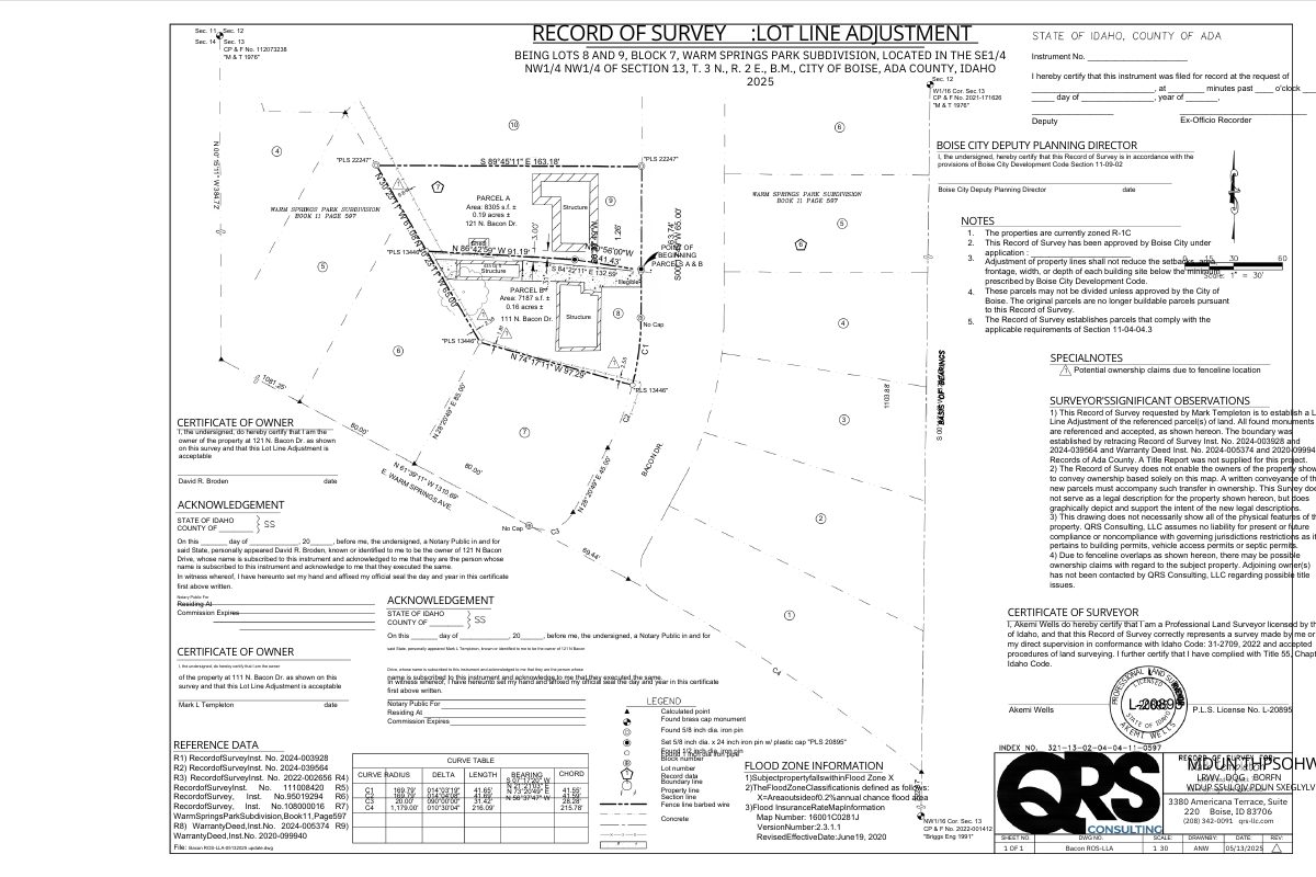
Boise City record of survey adjusting the lot line between Lots 8 and 9, Block 7, Warm Springs Park Subdivision, with boundary notes and a flagged fenceline ownership concern.
March 21, 2026 · 1 page · 422 KB · PDS-Other Small Docs
- Download Updated detailed site plan for lot line adjustment
Detailed site plan for Lots 8 and 9 in Warm Springs Park Subdivision showing Parcels A and B, areas, existing structures, and boundary survey notes, prepared by QRS Consulting.
March 21, 2026 · 1 page · 984 KB · PDS-Other Small Docs
- Download Detailed site plan for lot line adjustment
Survey-style detailed site plan for a lot line adjustment between two parcels, with parcel areas, existing structures, setbacks and property boundaries shown.
July 11, 2025 · 1 page · 476 KB · PDS-Other Small Docs
- Download Detailed site plan and record of survey for lot line adjustment
Survey of Lots 8 and 9 showing the proposed lot line adjustment, parcel boundaries, monuments, and notes that the resulting parcels comply with zoning requirements.
July 3, 2025 · 2 pages · 204 KB · PDS-Other Small Docs
Project narrative
- Download Concept review summary for a property line adjustment
Planner's concept review summary for a Type 2 property line adjustment, dated July 17, 2025, covering the required standards for conforming lots of record.
July 17, 2025 · 2 pages · 447 KB · PDS-Concept Review Summary Report
Notices
- Download Notice of buildable parcel for property line adjustment
Notice, notarized by both property owners, describing a buildable parcel created by a property line adjustment, with legal descriptions of the original and new parcels; valid only once a city deputy planning director…
July 3, 2025 · 9 pages · 456 KB · PDS-Other Small Docs
Application
- Download Planning project application for a lot line adjustment
Application for a lot line adjustment to be recorded with the city, filed by the applicant on behalf of the property owner, with a signed certification of accuracy.
July 3, 2025 · 2 pages · 153 KB · PDS-Application
- Download Record of Survey submittal requirements checklist
City checklist listing the documents required for a Record of Survey application, including the letter of explanation, legal interest statement, and proof of legal parcel.
July 3, 2025 · 4 pages · 210 KB · PDS-Other Small Docs
- Download Cover letter explaining lot line adjustment purpose
Survey consultant's cover letter stating the application resolves setback and driveway encroachment issues by adjusting a common lot line, and listing the enclosed deeds, plat, site plan and legal descriptions.
July 3, 2025 · 1 page · 43 KB · PDS-Other Small Docs
Other documents
- Download Record of survey for lot line adjustment
Survey of two adjacent lots in Warm Springs Park Subdivision, approved by Boise City, showing a lot line adjustment and related owner certificate and notes.
March 21, 2026 · 2 pages · 2.0 MB · PDS-Other Small Docs
- Download FEMA flood insurance rate map excerpt, panel 0281
FIRMette flood map excerpt for Ada County and Boise panel 1600100281, map revised June 19, 2020, with a note that later changes may not be reflected.
July 3, 2025 · 1 page · 171 KB · PDS-Other Small Docs
- Legal description for Lots A and B
July 3, 2025 · 298 KB · PDS-Other Small Docs
- Download Record of survey guide: what can I do with my property
Boise City Planning and Development Services form with questions and zoning setback, lot area, and lot width tables for checking whether a parcel can be split.
July 3, 2025 · 2 pages · 143 KB · PDS-Other Small Docs
- Warranty deeds from previous owners to current owners
July 3, 2025 · 130 KB · PDS-Other Small Docs


