Planning project · Planning application
Plan would combine two neighboring parcels into one lot with existing house
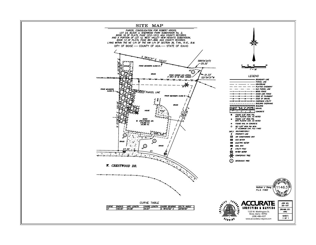
The owner of two adjoining parcels, about 0.4 acres in total, wants to merge them into one buildable lot. The existing single-family home would stay, with no change to parking or access. The city is reviewing the request administratively.
From the filing
The application's description as it appears in City of Boise's record. See the official record
Parcel Consolidation
Project name on file: 8250 W Crestwood DR
Timeline
Sept. 30, 2025
Pending Application Submittal: Planning Applications in Review
Sept. 3, 2025
Concept Review Complete: CR Complete - Type 2
Aug. 26, 2025
Application Submittal: Online
Aug. 26, 2025
Application filed
Documents
Site plans
- Download Site map for parcel consolidation
Survey site map by Accurate Surveying and Mapping showing existing features of the properties to be consolidated, stamped by a licensed surveyor.
Aug. 26, 2025 · 1 page · 178 KB · PDS-Other Small Docs
Project narrative
- Download Concept review summary for parcel consolidation
Planner's advisory summary finding that a Record of Survey is required to consolidate two contiguous parcels into one buildable parcel, with no neighborhood or IDR meeting needed.
Sept. 3, 2025 · 1 page · 447 KB · PDS-Concept Review Summary Report
Application
- Download Planning project application form
Application to consolidate two owned parcels, one containing the owner's existing residence in Sherwood Park Subdivision No. 2 and the other in West Valley View Heights, filed by a surveying company.
Aug. 26, 2025 · 2 pages · 154 KB · PDS-Application
Other documents
- Download Preliminary record of survey for parcel consolidation
Draft record of survey by Accurate Surveying and Mapping showing the parcel consolidation, with planning director approval block, notes on parcel division limits, zoning and references.
Aug. 26, 2025 · 1 page · 341 KB · PDS-Other Small Docs
- Download Parcel description report from landproDATA
Ada County assessor parcel report showing owner information, zoning R-1C, acreage, legal description, tax districts and assessed value for the parcel.
Aug. 26, 2025 · 179 KB · PDS-Other Small Docs
- Download Parcel description report from landproDATA
Property report for a single residential parcel in Ada County, listing owner, zoning (R-1C), legal lot description, land and residential characteristics, and related adjoining parcels.
Aug. 26, 2025 · 189 KB · PDS-Other Small Docs

