Record of survey · Planning application
Plan to combine two parcels into one lot approved with conditions
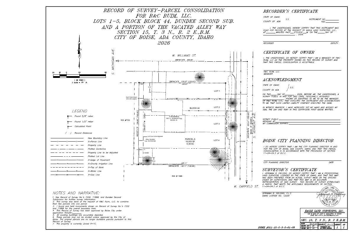
The city approved merging a lot holding an existing house with an adjoining half of a vacated alley, about 0.36 acres in all. Conditions include adding a sanitary sewer easement and getting the survey signed. No new buildings are described in the approval.
From the filing
The application's description as it appears in City of Boise's record. See the official record
The city approved a request to combine two existing parcels at 1801 S Vermont Ave in Boise into a single parcel. The parcels cover Lots 1-5 of Block 44 in Dundee Second Subdivision plus the east half of the adjoining vacated alley. No new buildings or housing units are described.
Parcel Consolidation, Legal Non- Conforming and new ADU
Project name on file: 1801 S VERMONT AVE
Timeline
Oct. 6, 2026
Review Complete: Completed
Oct. 6, 2026
Planning and Zoning: Complete
Sept. 4, 2026
Planning and Zoning: Corrections Required
Aug. 20, 2026
Planning and Zoning: Corrections Required
Aug. 19, 2026
Planning and Zoning: In Review
Aug. 19, 2026
Assign Reviewers: Completed
Aug. 18, 2026
Fee Payment: Payment Received
Aug. 17, 2026
Prescreen Review: Passed
Aug. 14, 2026
Prescreen Review: In Progress
Aug. 14, 2026
Application Submittal: ePlanReview
Completed Form.
Aug. 14, 2026
Application filed
Documents
Plans
- Download Dundee Second Subdivision plat (vacation of part of Williams St)
Record of survey plat showing a vacation of part of a street within the Dundee Second Subdivision, with block and lot dimensions and a notarized owner dedication; the scan text is largely illegible.
Sept. 23, 2026 · 1 page · 224 KB · PDS-Maps and Drawings
- Download Record of survey for parcel consolidation
Survey sheet showing lot lines to be adjusted, a quitclaim area of about 874 square feet, and a consolidated parcel of roughly 0.38 acres.
Sept. 23, 2026 · 1 page · 201 KB · PDS-Maps and Drawings
Project narrative
- Download Letter of explanation for lot line adjustment
Surveyor's letter describing a proposed lot line adjustment to combine two parcels into one, noting an existing house and that one parcel is half of a vacated alley.
Sept. 23, 2026 · 1 page · 318 KB · PDS-Letter of Intent
Decisions
- Download Administrative approval letter for parcel consolidation
Staff approval of a two-parcel consolidation into one, subject to conditions covering submittal items, survey revisions, and agency requirements.
Oct. 6, 2026 · 3 pages · 139 KB · PDS-Action Letter
Notices
- Download Notice of approval for parcel consolidation and ADU
Approval notice covering parcel consolidation, legal nonconforming confirmation, and an accessory dwelling unit in a residential zone, with an appeal deadline of October 16, 2026.
Oct. 2, 2026 · 2 pages · 785 KB · PDS-Legal Notice
Application
- Download Record of survey application form for property line adjustment
Application form for a record of survey covering a property line adjustment and parcel consolidation, with one proposed lot and a new accessory dwelling unit.
Aug. 14, 2026 · 2 pages · 199 KB · PDS-Application
Photos
- Download Site photos with proposed ADU location and shed removal
Site photos marked with the existing home to remain, the new ADU location, and the existing shed to be removed.
Sept. 23, 2026 · 2 pages · 17.6 MB · PDS-Photos
Correspondence
- Download Ada County Highway District comments
ACHD reports no required street improvements and lists fees, driveway permit, right-of-way permit, and standard conditions of approval for the property line adjustment.
Oct. 6, 2026 · 3 pages · 157 KB · PDS-Agency Comments
- Download Boise Fire Department comments
The Fire Department approves the lot line adjustment as presented, with no comments, and notes that future building or access changes must meet fire and building codes.
Oct. 6, 2026 · 2 pages · 354 KB · PDS-Agency Comments
- Download Public Works sewer comments
Public Works asks that the Boise City sanitary sewer easement be added to the record of survey, and includes irrigation comments.
Oct. 6, 2026 · 1 page · 93 KB · PDS-Agency Comments
Other documents
- Noticing radius map
Oct. 2, 2026 · 514 KB · PDS-Maps and Drawings
- Transmittal sheet
Sept. 25, 2026 · 143 KB · PDS-Transmittal Agencies
- Vicinity map
Sept. 23, 2026 · 416 KB · PDS-Maps and Drawings
- Legal description
Sept. 23, 2026 · 438 KB · PDS-Other Small Docs
- Quit claim deed
A quitclaim deed transferring property interest, included with the Record of Survey application.
Sept. 23, 2026 · 173 KB · PDS-Other Small Docs
- Payment receipt
Aug. 18, 2026 · 130 KB · PDS-Receipts


